Pharaoh’s Island Taba | Saladin Citadel Travel Guide

Pharaoh’s Island Taba

Egypt Tours ClubTaba · Gulf of Aqaba · medieval Sinai heritage
Pharaoh’s Island Taba Visitor Guide

Taba · Gulf of Aqaba · Saladin Citadel

Pharaoh’s Island Taba Visitor Guide

Explore a compact Gulf of Aqaba island where medieval fortifications, maritime strategy, mountain-and-sea panoramas and a short boat crossing come together in one focused South Sinai visit.

Quick Travel Answer

Why visit Pharaoh’s Island near Taba?

Pharaoh’s Island is a small fortified island roughly 250 metres off the Taba coast. Its main attraction is the restored medieval citadel associated with Salah El-Din, positioned to control movement through the northern Gulf of Aqaba.

The visit combines heritage with landscape: fortress walls, towers, interior spaces and elevated views sit above clear Gulf water and the rugged Sinai coast. Boat service, upper access and marine activities should always be confirmed locally.

A strategic island on a medieval Gulf route

History & Meaning

A strategic island on a medieval Gulf route

UNESCO’s Tentative List describes Pharaoh’s Island as a strategically important fortified site controlling movement around the Gulf of Aqaba. The island was occupied by Crusaders before Salah El-Din seized it and strengthened the fortress during the Ayyubid period.

The surviving complex includes defensive walls and towers together with spaces used for administration, guards, storage, water management, worship and daily garrison life. The island’s value lies in understanding how military architecture worked with the surrounding maritime geography.

The UNESCO record is a Tentative List entry submitted by Egypt, not a World Heritage inscription. This page therefore treats it accurately as an important heritage reference rather than claiming full World Heritage status.

Open the UNESCO Tentative List record

Main Experiences

What to see on Pharaoh’s Island

Read the island from the waterline upward: approach, fortifications, internal life, strategic views and the surrounding Gulf.

Citadel of Salah El-Din
Medieval fortress

Citadel of Salah El-Din

Walk through a fortified complex of walls, towers, entrances and internal spaces that reveal how this small island controlled a major maritime corridor.

Read the UNESCO heritage record
Fortress Interiors
Garrison life

Fortress Interiors

Look for the mosque, cisterns, service areas, stores and guard spaces that explain how a permanent defensive post could function on a small island.

Explore wider Sinai planning
Gulf of Aqaba Views
Strategic geography

Gulf of Aqaba Views

Elevated positions show why the island mattered: the narrow Gulf, surrounding mountains and nearby coastlines turn geography into part of the historical story.

Open the Dahab destination guide
Boat Approach
Arrival experience

Boat Approach

The short crossing gives the clearest impression of the citadel rising directly from the water and separates the island visit from a standard roadside monument stop.

Compare South Sinai tours
Marine Setting
Optional sea time

Marine Setting

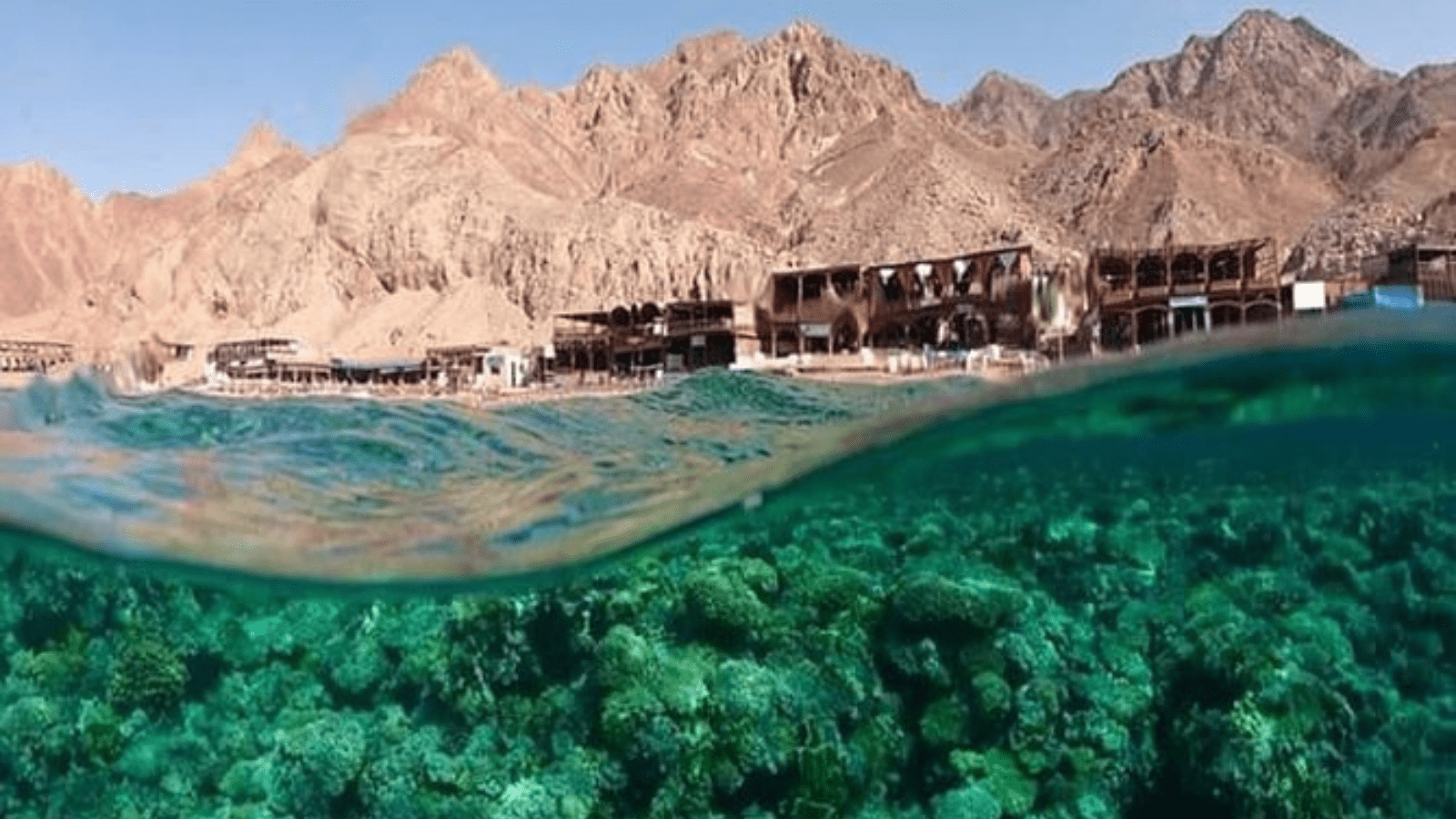
Clear water and coral scenery can make swimming or snorkeling attractive when current access, weather, safety and operator arrangements allow.

Continue to Ras Mohammed planning
Taba & Sinai Context
Regional route

Taba & Sinai Context

Use the island as one stop within a realistic northern South Sinai day rather than combining too many distant places into an exhausting itinerary.

Build a private route

What to Prioritize

If your time is limited, focus on these four things

01

Fortress Structure

Read the walls, towers and entrance sequence before concentrating on smaller details.

02

Water & Daily Life

Notice cisterns, service rooms and circulation that made a garrison possible on an island.

03

Strategic View

Use the upper viewpoints to connect the fortress with the Gulf of Aqaba and surrounding routes.

04

Boat Perspective

Look back at the citadel from the water or jetty; the island’s defensive logic is easiest to understand from outside.

Suggested Visit Flow

A practical way to explore Pharaoh’s Island

Confirm the Crossing

Check the operating boat point, current access and weather before committing to a fixed schedule.

Approach the Fortress

Use the boat ride to understand the island’s defensive position and relationship with the coast.

Tour the Citadel

Move through walls, towers, mosque, water systems and garrison spaces at a comfortable pace.

Finish with the View

Allow time for the Gulf panorama, photographs and any optional marine activity that is actually operating.

Tickets, Boat Access & Safety

Use current local information for operating details

Boat service, ticketing, checkpoints, site opening arrangements and marine activities can change. Keep the page durable by confirming these details close to the visit instead of publishing fixed times or prices.

Planning questionDurable guidanceVerify before travel
Boat crossingExpect a short local boat transfer from the Taba coast rather than road access to the island.Current departure point, frequency and whether service is operating.
Site accessPlan for historic stone surfaces, stairs and exposed sections.Any closed rooms, restricted upper areas or conservation work.
IdentificationTaba is a border-sensitive region and procedures can vary.Current identification and checkpoint requirements for your exact route.
SnorkelingTreat marine activity as optional and condition-dependent.Sea state, permitted area, equipment, supervision and operator availability.
PhotographyUse secure equipment on stairs and exposed walls.Any local restrictions for professional equipment or specific areas.

Practical Visitor Planning

What to know before you go

01

Best Time of Day

Morning can offer cooler conditions and a more comfortable fortress walk; confirm actual operating times first.

02

Visit Duration

Allow roughly two to three hours as a flexible framework for crossing, heritage visit and viewpoints.

03

Footwear

Use stable closed shoes for stone paving, stairs and uneven historic surfaces.

04

What to Bring

Water, sun protection, hat and only the photography or snorkeling gear you can manage comfortably.

05

Families

Families can enjoy the boat and fortress, but supervise children closely around stairs, edges and exposed battlements.

06

Accessibility

Historic stairs and uneven surfaces can limit upper access. Confirm the current route if mobility is reduced.

07

Photography

The strongest compositions often combine fortress walls, Gulf water and Sinai mountains rather than focusing only on interiors.

08

Guide Value

A knowledgeable guide helps explain Crusader, Ayyubid and later layers without reducing the island to a generic castle.

09

Route Base

Taba is the natural base; Dahab and Sharm require longer road planning and should not be treated like nearby resort transfers.

Local expert advice: make the island the main event of the Taba portion of the day. Build enough margin for the boat and checkpoints, then add only one or two nearby stops instead of forcing a long multi-destination schedule.

Nearby Combinations

Build the right South Sinai route

Keep this page focused on Pharaoh’s Island, then move to the destination or tour page that owns the next planning question.

Trusted References

Authoritative and practical sources

Use UNESCO for the historic fortification record and Egypt Tours Club destination pages for current route planning.

UNESCO Tentative List

Historic description of the two Saladin-period citadels in Sinai, including Pharaoh’s Island.

UNESCO Tentative List

Egypt Tours Club — Sharm El Sheikh

Destination-planning context for South Sinai, Red Sea activities and longer excursions.

Egypt Tours Club — Sharm El Sheikh

Egypt Tours Club — Dahab

Destination-planning context for a quieter Red Sea base and wider Sinai experiences.

Egypt Tours Club — Dahab

Frequently Asked Questions

Pharaoh’s Island Taba questions before you go

Direct answers about history, the boat crossing, visit length, snorkeling, safety and wider South Sinai planning.

Where is Pharaoh’s Island?

Pharaoh’s Island lies just offshore from Taba in the northern Gulf of Aqaba in South Sinai.

What is the main attraction?

The main attraction is the restored medieval citadel associated with Salah El-Din and the strategic defense of Gulf routes.

Is Pharaoh’s Island a UNESCO World Heritage Site?

No. It appears on Egypt’s UNESCO Tentative List as part of the entry for two Saladin-period citadels in Sinai; a Tentative List entry is not the same as inscription on the World Heritage List.

Who controlled the island in the medieval period?

UNESCO’s record describes Crusader occupation followed by Salah El-Din’s seizure and strengthening of the fortress during the Ayyubid period.

How do visitors reach the island?

Visitors normally use a short local boat crossing from the Taba coast. The exact departure point and operation should be confirmed locally.

How long should I allow?

Roughly two to three hours is a useful flexible framework for the boat, fortress, viewpoints and a relaxed visit.

Can I snorkel around the island?

Snorkeling may be possible when local access, sea conditions and operator arrangements allow, but it should be treated as optional rather than guaranteed.

What footwear should I wear?

Use stable closed shoes with grip because the citadel has stone paths, stairs and uneven surfaces.

Is the island suitable for children?

Yes for many families, but close supervision is important around stairs, walls, exposed edges and boat boarding.

Is the island accessible for limited mobility?

Some ground-level areas may be easier than upper fortress sections, but historic stairs and uneven surfaces can make the full route difficult.

Do I need identification in Taba?

Procedures can vary in this border-sensitive region. Confirm current identification and checkpoint requirements before departure.

What can I see from the upper fortress?

The viewpoints emphasize the Gulf of Aqaba, surrounding mountains and nearby coastlines, explaining the island’s strategic position.

What survives inside the citadel?

The UNESCO record describes defensive structures together with a mosque, water cisterns, service areas, stores, guard spaces and other functional rooms.

Can I visit from Dahab?

Yes, but it requires a longer road day than a Taba-based visit. Confirm travel time, checkpoints and boat operation before finalizing the route.

Can I visit from Sharm El Sheikh?

Yes as part of a longer organized Sinai day, but the road journey is substantial and the itinerary should stay realistic.

What should I combine with the island?

Taba coastal scenery is the most natural pairing. A wider trip can later connect with Dahab, Sharm El Sheikh or other Sinai experiences.

Is a guide useful?

Yes. A guide can explain the relationship between Crusader occupation, Ayyubid fortification, Gulf routes and the functioning of the garrison.

What is the best way to plan the visit?

Confirm boat access and local procedures first, keep the timing flexible, prioritize the fortress and views, and add marine activity only when conditions support it.


Private South Sinai Planning

Build Pharaoh’s Island into a realistic Taba route

Use the island as the heritage anchor, then add the coast or a wider Sinai stop according to your hotel base, road time, boat operation and energy level.